
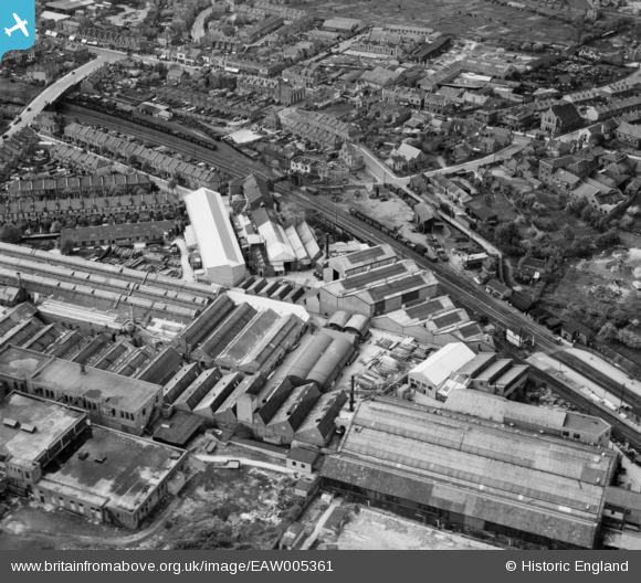
EAW005361 ENGLAND (1947). The Graydon Engineering and Welding Co Ltd Works and the surrounding area, Fishponds, 1947
© Copyright OpenStreetMap contributors and licensed by the OpenStreetMap Foundation. 2026. Cartography is licensed as CC BY-SA.
Nearby Images (27)
EAW005361

EAW005352

EAW005350

EAW005358

EAW005351

EAW005353

EAW005357

EAW005362

EAW005356

EAW005359

EAW005360

EAW015027

EAW015023

EAW005354

EAW015028

EPW014738

EAW015025

EAW015026

EAW005355

EAW005363

EPW014739

EAW005364

EAW015029

EAW015024

EAW032266

EAW032262

EAW032264

Details
| Title | [EAW005361] The Graydon Engineering and Welding Co Ltd Works and the surrounding area, Fishponds, 1947 |
| Reference | EAW005361 |
| Date | 13-May-1947 |
| Link | |
| Place name | FISHPONDS |
| Parish | |
| District | |
| Country | ENGLAND |
| Easting / Northing | 363169, 175485 |
| Longitude / Latitude | -2.5303901478856, 51.4766384551 |
| National Grid Reference | ST632755 |
Pins

Class31 |
Friday 28th of February 2014 10:50:07 PM | |
|
Class31 |
Friday 28th of February 2014 03:33:07 PM | |
|
Class31 |
Friday 28th of February 2014 09:53:33 AM | |
|
Class31 |
Friday 28th of February 2014 09:45:59 AM | |
|
Class31 |
Friday 28th of February 2014 09:31:29 AM |