
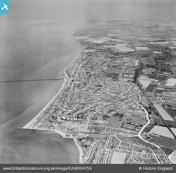
EAW004750 ENGLAND (1947). The town and the surrounding coastline, Herne Bay, from the west, 1947
© Copyright OpenStreetMap contributors and licensed by the OpenStreetMap Foundation. 2026. Cartography is licensed as CC BY-SA.
Nearby Images (2)
EAW004750

EAW004751

Details
| Title | [EAW004750] The town and the surrounding coastline, Herne Bay, from the west, 1947 |
| Reference | EAW004750 |
| Date | 26-April-1947 |
| Link | |
| Place name | HERNE BAY |
| Parish | |
| District | |
| Country | ENGLAND |
| Easting / Northing | 615982, 167843 |
| Longitude / Latitude | 1.1032390531532, 51.368010368691 |
| National Grid Reference | TR160678 |
Pins

Sparky |
Wednesday 23rd of August 2017 11:50:13 PM | |
|
Sparky |
Wednesday 28th of June 2017 08:30:50 AM | |

John Wass |
Friday 17th of April 2015 09:06:38 PM |