
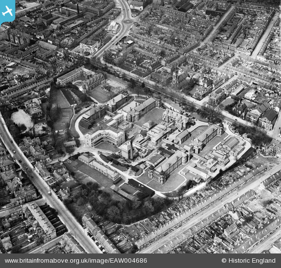
EAW004686 ENGLAND (1947). The Royal Infirmary (London Road Community Hospital), Derby, 1947
© Copyright OpenStreetMap contributors and licensed by the OpenStreetMap Foundation. 2026. Cartography is licensed as CC BY-SA.
Nearby Images (5)
EAW004686
, Derby, 1947")
EAW004685
, Derby, 1947")
EPW041814

EAW004657

EAW004652

Details
| Title | [EAW004686] The Royal Infirmary (London Road Community Hospital), Derby, 1947 |
| Reference | EAW004686 |
| Date | 22-April-1947 |
| Link | |
| Place name | DERBY |
| Parish | |
| District | |
| Country | ENGLAND |
| Easting / Northing | 435702, 335503 |
| Longitude / Latitude | -1.4689942246124, 52.915443521663 |
| National Grid Reference | SK357355 |
Pins

60's Soul |
Saturday 24th of January 2026 10:14:11 PM | |
|
60's Soul |
Saturday 24th of January 2026 10:13:22 PM | |
|
60's Soul |
Saturday 24th of January 2026 10:04:09 PM | |
|
60's Soul |
Saturday 24th of January 2026 10:02:42 PM | |
|
60's Soul |
Saturday 24th of January 2026 10:01:31 PM | |
|
60's Soul |
Saturday 24th of January 2026 09:59:15 PM | |
|
60's Soul |
Saturday 24th of January 2026 09:57:32 PM | |

melgibbs |
Sunday 30th of November 2014 04:49:54 PM | |
|
melgibbs |
Sunday 30th of November 2014 04:48:53 PM | |
 |
melgibbs |
Sunday 30th of November 2014 04:48:06 PM |