
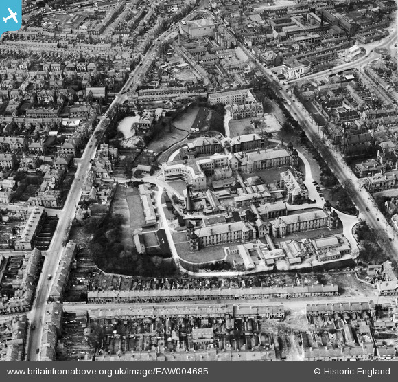
EAW004685 ENGLAND (1947). The Royal Infirmary (London Road Community Hospital), Derby, 1947
© Copyright OpenStreetMap contributors and licensed by the OpenStreetMap Foundation. 2026. Cartography is licensed as CC BY-SA.
Nearby Images (5)
EAW004685
, Derby, 1947")
EAW004686
, Derby, 1947")
EPW041814

EAW004657

EAW004652

Details
| Title | [EAW004685] The Royal Infirmary (London Road Community Hospital), Derby, 1947 |
| Reference | EAW004685 |
| Date | 22-April-1947 |
| Link | |
| Place name | DERBY |
| Parish | |
| District | |
| Country | ENGLAND |
| Easting / Northing | 435663, 335464 |
| Longitude / Latitude | -1.4695785390793, 52.91509550404 |
| National Grid Reference | SK357355 |
Pins

aRJay |
Monday 30th of June 2014 04:28:26 PM | |

Peter Kazmierczak |
Saturday 14th of June 2014 01:01:57 PM | |
|
Peter Kazmierczak |
Saturday 14th of June 2014 01:01:14 PM | |
|
Peter Kazmierczak |
Saturday 14th of June 2014 01:00:22 PM | |
|
william |
Sunday 8th of June 2014 04:24:38 PM | |
|
nathanielbagshot |
Sunday 25th of August 2013 06:17:39 PM |