
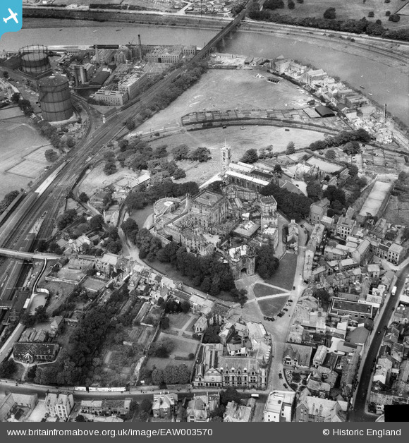
EAW003570 ENGLAND (1947). Lancaster Castle, St Mary's Church and the surrounding area, Lancaster, 1947
© Copyright OpenStreetMap contributors and licensed by the OpenStreetMap Foundation. 2026. Cartography is licensed as CC BY-SA.
Nearby Images (15)
EAW003570

EPW042027

EAW005629

EAW037592

EPW029178

EAW005630

EAW005632

EAW005633

EPW042028

EAW005631

EPW026404

EAW023386

EPW002092

EAW023385

EPW002086

Details
| Title | [EAW003570] Lancaster Castle, St Mary's Church and the surrounding area, Lancaster, 1947 |
| Reference | EAW003570 |
| Date | March-1947 |
| Link | |
| Place name | LANCASTER |
| Parish | |
| District | |
| Country | ENGLAND |
| Easting / Northing | 347353, 461851 |
| Longitude / Latitude | -2.8042082781906, 54.049745019269 |
| National Grid Reference | SD474619 |
Pins

Sparky |
Thursday 28th of September 2017 08:43:34 PM | |
|
Sparky |
Thursday 28th of September 2017 08:09:08 PM | |

John Wass |
Saturday 10th of January 2015 07:55:00 PM | |
|
John Wass |
Saturday 10th of January 2015 07:53:04 PM |
User Comment Contributions
is the month of march correct?, trees are in full leaf |
steve |
Thursday 12th of September 2013 08:21:35 PM |