
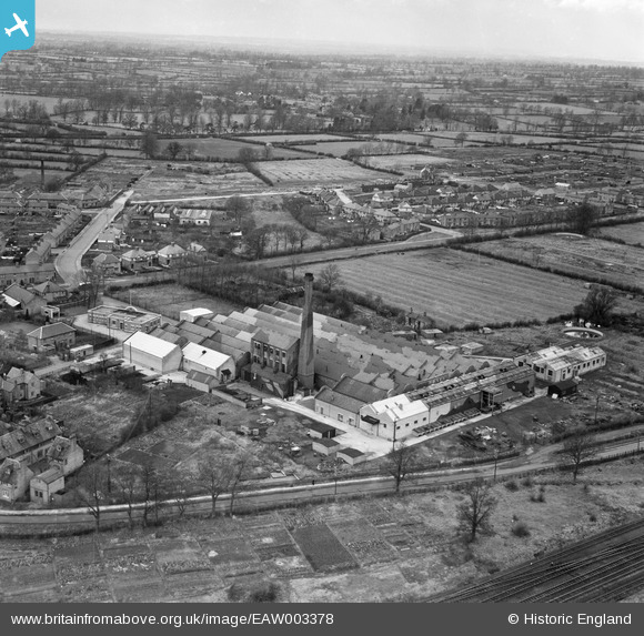
EAW003378 ENGLAND (1946). The Vedonis Works, Lutterworth, from the south-east, 1946
© Copyright OpenStreetMap contributors and licensed by the OpenStreetMap Foundation. 2026. Cartography is licensed as CC BY-SA.
Nearby Images (24)
EAW003378

EAW003377

EAW052454

EAW052455

EPW019708

EAW052459

EAW003371

EPW019712

EAW003375

EAW052456

EAW003376

EAW003374

EAW003373

EPW019710

EPW019711

EPW019709

EAW052452

EAW052453

EAW052457

EAW003372

EAW003381

EAW003379

EAW003380

EAW052458

Details
| Title | [EAW003378] The Vedonis Works, Lutterworth, from the south-east, 1946 |
| Reference | EAW003378 |
| Date | 26-November-1946 |
| Link | |
| Place name | LUTTERWORTH |
| Parish | LUTTERWORTH |
| District | |
| Country | ENGLAND |
| Easting / Northing | 454735, 284906 |
| Longitude / Latitude | -1.1943521604946, 52.458984638445 |
| National Grid Reference | SP547849 |
