
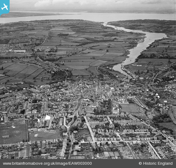
EAW003000 ENGLAND (1946). The town and River Medina looking towards The Solent, Newport, from the south, 1946
© Copyright OpenStreetMap contributors and licensed by the OpenStreetMap Foundation. 2026. Cartography is licensed as CC BY-SA.
Nearby Images (10)
EAW003000

EAW022225

EPW032329

EPW032330

EPW023021

EPW032333

EPW039660

EAW022226

EPW023024

EPW032334

Details
| Title | [EAW003000] The town and River Medina looking towards The Solent, Newport, from the south, 1946 |
| Reference | EAW003000 |
| Date | 3-October-1946 |
| Link | |
| Place name | NEWPORT |
| Parish | NEWPORT |
| District | |
| Country | ENGLAND |
| Easting / Northing | 449946, 88995 |
| Longitude / Latitude | -1.2927218674368, 50.697875643698 |
| National Grid Reference | SZ499890 |
Pins

wessexpig |
Saturday 24th of August 2013 12:04:08 AM |