
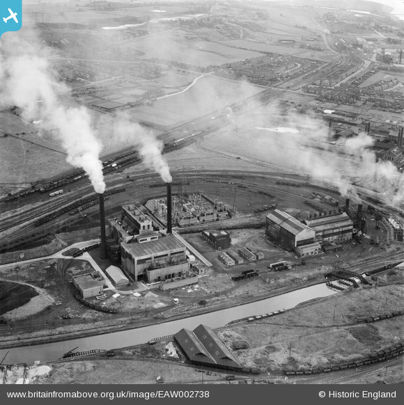
EAW002738 ENGLAND (1946). Percival Lane Power Station, Runcorn, 1946
© Copyright OpenStreetMap contributors and licensed by the OpenStreetMap Foundation. 2026. Cartography is licensed as CC BY-SA.
Nearby Images (14)
EAW002738

EAW016787

EAW002742

EAW002743

EAW002739

EAW005673

EAW002740

EAW005671

EAW002741

EAW002735

EAW005672

EAW005662

EAW005667

EAW005668

Details
| Title | [EAW002738] Percival Lane Power Station, Runcorn, 1946 |
| Reference | EAW002738 |
| Date | 11-September-1946 |
| Link | |
| Place name | RUNCORN |
| Parish | |
| District | |
| Country | ENGLAND |
| Easting / Northing | 349787, 381934 |
| Longitude / Latitude | -2.7540848037282, 53.331663335343 |
| National Grid Reference | SJ498819 |
Pins

Bottom Yard |
Saturday 7th of June 2025 04:24:12 PM | |
|
Bottom Yard |
Sunday 30th of March 2025 04:26:27 PM | |
|
Bottom Yard |
Tuesday 8th of October 2024 04:12:06 PM | |
|
Bottom Yard |
Tuesday 8th of October 2024 10:46:58 AM | |
|
Bottom Yard |
Tuesday 8th of October 2024 10:35:01 AM | |

Sparky |
Saturday 16th of September 2017 06:01:21 PM | |
|
Sparky |
Friday 18th of August 2017 05:26:48 PM |