
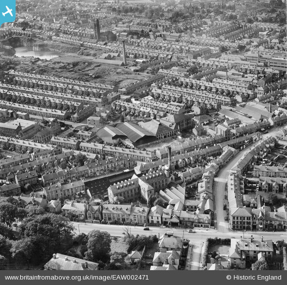
EAW002471 ENGLAND (1946). Ernest Turner Spa Lane Mills and environs, Derby, 1946
© Copyright OpenStreetMap contributors and licensed by the OpenStreetMap Foundation. 2026. Cartography is licensed as CC BY-SA.
Nearby Images (8)
EAW002471

EAW002475

EAW002474

EAW002469

EAW002472

EAW002470

EAW002473

EPW055019

Details
| Title | [EAW002471] Ernest Turner Spa Lane Mills and environs, Derby, 1946 |
| Reference | EAW002471 |
| Date | 6-September-1946 |
| Link | |
| Place name | DERBY |
| Parish | |
| District | |
| Country | ENGLAND |
| Easting / Northing | 434784, 335437 |
| Longitude / Latitude | -1.4826543491113, 52.914910416144 |
| National Grid Reference | SK348354 |
Pins

60's Soul |
Monday 2nd of February 2026 06:39:28 AM | |
|
60's Soul |
Monday 2nd of February 2026 06:37:28 AM | |
|
60's Soul |
Monday 2nd of February 2026 06:35:40 AM | |
|
redmist |
Saturday 28th of October 2023 07:06:35 PM | |
|
Giff |
Saturday 21st of December 2013 04:11:40 PM | |
|
Giff |
Saturday 21st of December 2013 04:10:53 PM |