
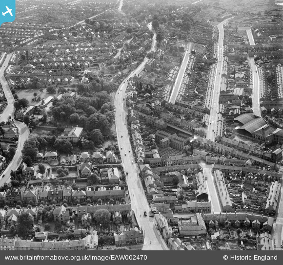
EAW002470 ENGLAND (1946). Burton Road at Spa Lane and environs, Derby, 1946
© Copyright OpenStreetMap contributors and licensed by the OpenStreetMap Foundation. 2026. Cartography is licensed as CC BY-SA.
Nearby Images (7)
EAW002470

EAW002473

EAW002472

EAW002475

EAW002471

EAW002474

EAW002469

Details
| Title | [EAW002470] Burton Road at Spa Lane and environs, Derby, 1946 |
| Reference | EAW002470 |
| Date | 6-September-1946 |
| Link | |
| Place name | DERBY |
| Parish | |
| District | |
| Country | ENGLAND |
| Easting / Northing | 434886, 335362 |
| Longitude / Latitude | -1.481145419668, 52.914229552833 |
| National Grid Reference | SK349354 |
Pins

60's Soul |
Sunday 25th of January 2026 03:18:12 PM | |
|
60's Soul |
Sunday 25th of January 2026 03:12:07 PM | |
|
60's Soul |
Sunday 25th of January 2026 03:11:44 PM | |
|
60's Soul |
Sunday 25th of January 2026 03:07:48 PM | |
|
60's Soul |
Sunday 25th of January 2026 03:06:56 PM | |
|
60's Soul |
Sunday 25th of January 2026 03:06:23 PM | |
|
John Wass |
Tuesday 17th of March 2015 08:46:11 PM | |

Peter Kazmierczak |
Wednesday 25th of September 2013 11:52:38 PM | |
|
Peter Kazmierczak |
Wednesday 25th of September 2013 11:51:32 PM | |
|
Peter Kazmierczak |
Wednesday 25th of September 2013 11:50:45 PM | |
|
Peter Kazmierczak |
Wednesday 25th of September 2013 11:49:36 PM | |
|
Peter Kazmierczak |
Wednesday 25th of September 2013 11:48:58 PM | |
|
Peter Kazmierczak |
Wednesday 25th of September 2013 11:48:12 PM | |
|
Peter Kazmierczak |
Wednesday 25th of September 2013 11:47:11 PM | |
|
Peter Kazmierczak |
Wednesday 25th of September 2013 11:46:14 PM |