
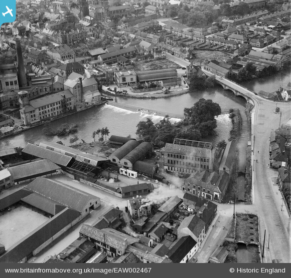
EAW002467 ENGLAND (1946). St Mary's Bridge and nearby industrial buildings, Derby, 1946
© Copyright OpenStreetMap contributors and licensed by the OpenStreetMap Foundation. 2026. Cartography is licensed as CC BY-SA.
Nearby Images (12)
EAW002467

EPW055025

EAW002465

EAW002466

EAW002468

EPW021119

EPW021122

EPW021123

EPW021120

EPW021121

EAW004660

EAW004663

Details
| Title | [EAW002467] St Mary's Bridge and nearby industrial buildings, Derby, 1946 |
| Reference | EAW002467 |
| Date | 6-September-1946 |
| Link | |
| Place name | DERBY |
| Parish | |
| District | |
| Country | ENGLAND |
| Easting / Northing | 435409, 336647 |
| Longitude / Latitude | -1.4732270916581, 52.92574742841 |
| National Grid Reference | SK354366 |
Pins

Sparky |
Sunday 17th of September 2017 02:57:24 PM | |

phillrooney |
Wednesday 3rd of September 2014 02:59:31 PM | |
|
phillrooney |
Wednesday 3rd of September 2014 02:56:48 PM |

