
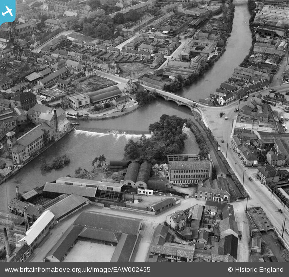
EAW002465 ENGLAND (1946). St Mary's Bridge and nearby industrial buildings, Derby, 1946
© Copyright OpenStreetMap contributors and licensed by the OpenStreetMap Foundation. 2026. Cartography is licensed as CC BY-SA.
Nearby Images (12)
EAW002465

EAW002467

EPW055025

EAW002468

EAW002466

EPW021119

EPW021122

EPW021123

EPW021121

EPW021120

EAW004661

EAW004663

Details
| Title | [EAW002465] St Mary's Bridge and nearby industrial buildings, Derby, 1946 |
| Reference | EAW002465 |
| Date | 6-September-1946 |
| Link | |
| Place name | DERBY |
| Parish | |
| District | |
| Country | ENGLAND |
| Easting / Northing | 435390, 336688 |
| Longitude / Latitude | -1.4735052661881, 52.926117269011 |
| National Grid Reference | SK354367 |
Pins

aremla |
Saturday 16th of December 2023 04:44:38 PM | |
|
aremla |
Saturday 16th of December 2023 04:44:24 PM | |
|
aremla |
Saturday 16th of December 2023 04:40:16 PM | |
|
sammy7 |
Saturday 2nd of May 2020 01:45:33 AM | |
|
sammy7 |
Saturday 2nd of May 2020 01:42:59 AM | |
|
sammy7 |
Saturday 2nd of May 2020 01:41:21 AM | |
|
sammy7 |
Saturday 2nd of May 2020 01:34:42 AM | |
|
sammy7 |
Saturday 2nd of May 2020 01:32:56 AM | |
|
sammy7 |
Saturday 2nd of May 2020 01:31:01 AM | |

Sparky |
Sunday 17th of September 2017 02:53:28 PM | |
|
Sparky |
Sunday 17th of September 2017 02:52:21 PM | |
|
John Wass |
Sunday 30th of July 2017 07:29:46 PM | |
|
gBr |
Monday 21st of September 2015 09:19:39 PM | |
|
phillrooney |
Wednesday 3rd of September 2014 02:19:16 PM | |
|
phillrooney |
Wednesday 3rd of September 2014 02:16:24 PM |

