
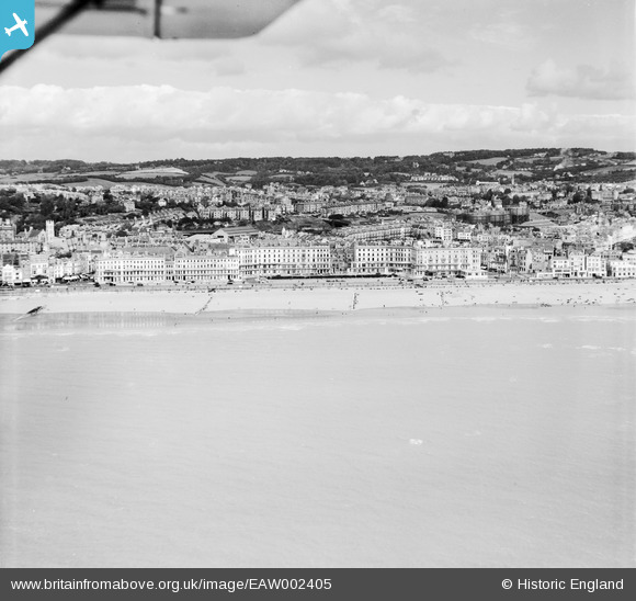
EAW002405 ENGLAND (1946). The town and seafront centred upon Carlisle Parade, Hastings, from the south, 1946
© Copyright OpenStreetMap contributors and licensed by the OpenStreetMap Foundation. 2026. Cartography is licensed as CC BY-SA.
Nearby Images (6)
EAW002405

EAW002406

EAW002404

EPW039370

EPW039369

EAW002407

Details
| Title | [EAW002405] The town and seafront centred upon Carlisle Parade, Hastings, from the south, 1946 |
| Reference | EAW002405 |
| Date | 16-September-1946 |
| Link | |
| Place name | HASTINGS |
| Parish | |
| District | |
| Country | ENGLAND |
| Easting / Northing | 581625, 109019 |
| Longitude / Latitude | 0.58057204285798, 50.851573296019 |
| National Grid Reference | TQ816090 |
Pins
Be the first to add a comment to this image!