
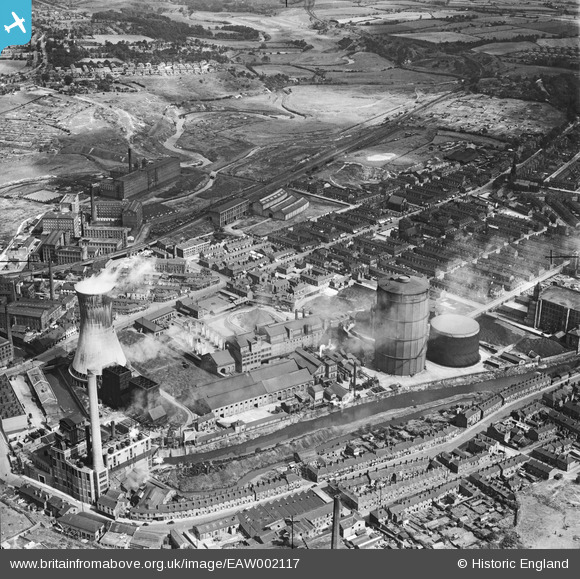
EAW002117 ENGLAND (1946). Portwood Gas Works and environs, Stockport, 1946
© Copyright OpenStreetMap contributors and licensed by the OpenStreetMap Foundation. 2026. Cartography is licensed as CC BY-SA.
Nearby Images (10)
EAW002117

EAW002118

EAW002116

EAW002111

EAW002109

EAW002110

EAW002115

EAW002112

EAW002113

EAW002114

Details
| Title | [EAW002117] Portwood Gas Works and environs, Stockport, 1946 |
| Reference | EAW002117 |
| Date | 1-August-1946 |
| Link | |
| Place name | STOCKPORT |
| Parish | |
| District | |
| Country | ENGLAND |
| Easting / Northing | 390089, 390869 |
| Longitude / Latitude | -2.1491277201174, 53.41427548307 |
| National Grid Reference | SJ901909 |
Pins

guisto11 |
Monday 14th of March 2022 06:36:32 PM | |
|
JonnyBGoode |
Monday 6th of December 2021 01:52:43 PM | |
|
JonnyBGoode |
Monday 6th of December 2021 01:47:48 PM | |
|
JonnyBGoode |
Monday 6th of December 2021 01:47:17 PM | |
|
JonnyBGoode |
Monday 6th of December 2021 01:42:03 PM | |
|
JonnyBGoode |
Monday 6th of December 2021 01:38:25 PM | |
|
stardelta |
Thursday 19th of June 2014 11:13:26 PM | |
|
stardelta |
Thursday 19th of June 2014 10:36:49 PM | |
|
stardelta |
Thursday 19th of June 2014 09:28:53 PM | |
|
PhilG |
Monday 9th of June 2014 02:48:09 PM | |
|
PhilG |
Monday 9th of June 2014 02:46:07 PM | |
|
PhilG |
Monday 9th of June 2014 02:45:19 PM | |
|
PhilG |
Monday 9th of June 2014 02:44:32 PM | |
|
PhilG |
Friday 6th of June 2014 07:21:07 PM |