
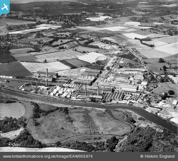
EAW001974 ENGLAND (1946). Aylesford Paper Mills, Ditton, from the north-east, 1946
© Copyright OpenStreetMap contributors and licensed by the OpenStreetMap Foundation. 2026. Cartography is licensed as CC BY-SA.
Nearby Images (17)
EAW001974

EPW046001

EPW045999

EAW001977

EPW046000

EPW045998

EAW018286

EPW046002

EAW001975

EPW045997

EAW001979

EPW047728

EPW047727

EAW001976

EAW001973

EAW018288

EAW018287

Details
| Title | [EAW001974] Aylesford Paper Mills, Ditton, from the north-east, 1946 |
| Reference | EAW001974 |
| Date | 25-July-1946 |
| Link | |
| Place name | DITTON |
| Parish | DITTON |
| District | |
| Country | ENGLAND |
| Easting / Northing | 571478, 159805 |
| Longitude / Latitude | 0.46064822553441, 51.310979561099 |
| National Grid Reference | TQ715598 |
Pins

Sparky |
Monday 18th of September 2017 11:00:46 PM | |

Dylan Moore |
Tuesday 15th of July 2014 02:38:01 AM |