
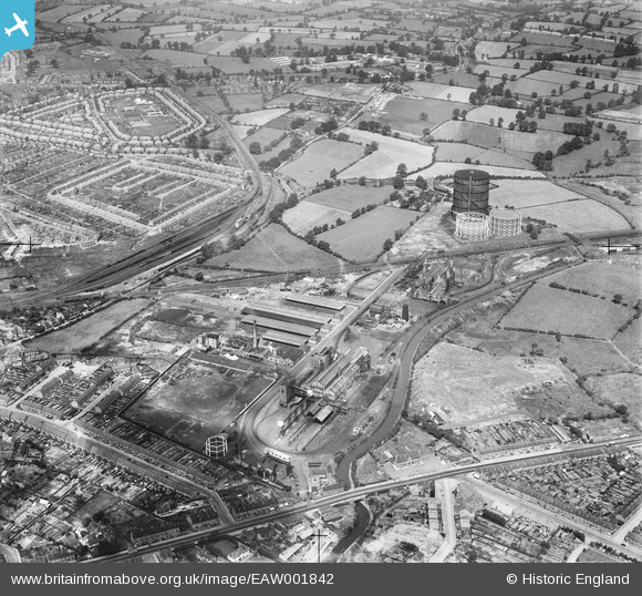
EAW001842 ENGLAND (1946). The Gas Works at Longford and the surrounding residential area, Longford, 1946
© Copyright OpenStreetMap contributors and licensed by the OpenStreetMap Foundation. 2026. Cartography is licensed as CC BY-SA.
Nearby Images (11)
EAW001842

EAW001841

EPW039608

EAW001837

EPW039609

EPW039612

EAW001838

EAW001839

EPW027271

EAW001836

EAW001840

Details
| Title | [EAW001842] The Gas Works at Longford and the surrounding residential area, Longford, 1946 |
| Reference | EAW001842 |
| Date | 12-July-1946 |
| Link | |
| Place name | LONGFORD |
| Parish | |
| District | |
| Country | ENGLAND |
| Easting / Northing | 434432, 283274 |
| Longitude / Latitude | -1.493345241518, 52.445969619799 |
| National Grid Reference | SP344833 |
Pins

redmist |
Saturday 29th of October 2022 09:00:54 PM | |
|
Darren |
Saturday 20th of April 2019 03:31:38 AM | |

Sparky |
Tuesday 25th of July 2017 11:53:17 PM | |
|
Derrickarthur |
Wednesday 19th of March 2014 10:53:49 PM | |
|
Tezzacov |
Thursday 12th of September 2013 03:31:30 PM | |
|
Tezzacov |
Thursday 12th of September 2013 03:30:11 PM | |
|
Tezzacov |
Thursday 12th of September 2013 03:27:27 PM |