
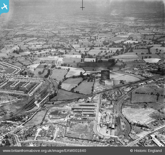
EAW001840 ENGLAND (1946). The Gas Works at Longford and the surrounding countryside, Longford, from the south-east, 1946
© Copyright OpenStreetMap contributors and licensed by the OpenStreetMap Foundation. 2026. Cartography is licensed as CC BY-SA.
Nearby Images (12)
EAW001840

EPW027271

EPW039608

EPW039606

EPW039609

EPW039612

EAW001842

EAW001841

EAW001837

EAW001836

EAW001839

EAW001838

Details
| Title | [EAW001840] The Gas Works at Longford and the surrounding countryside, Longford, from the south-east, 1946 |
| Reference | EAW001840 |
| Date | 12-July-1946 |
| Link | |
| Place name | LONGFORD |
| Parish | |
| District | |
| Country | ENGLAND |
| Easting / Northing | 434510, 283115 |
| Longitude / Latitude | -1.4922139857697, 52.444535175459 |
| National Grid Reference | SP345831 |
Pins

redmist |
Saturday 29th of October 2022 08:58:48 PM | |
|
Davethefish |
Tuesday 6th of October 2020 11:33:43 PM | |
|
Darren |
Saturday 20th of April 2019 02:39:13 AM | |

Sparky |
Tuesday 8th of August 2017 08:17:06 AM | |
|
Tezzacov |
Tuesday 11th of February 2014 06:04:46 PM | |
|
Tezzacov |
Tuesday 11th of February 2014 06:03:04 PM | |
|
Tezzacov |
Tuesday 11th of February 2014 05:59:25 PM | |
|
Tezzacov |
Tuesday 11th of February 2014 05:54:47 PM | |
|
Dean |
Friday 15th of November 2013 02:53:12 PM | |
|
MB |
Sunday 6th of October 2013 06:36:31 PM |
