
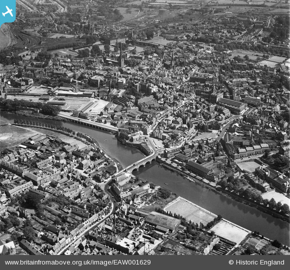
EAW001629 ENGLAND (1946). Welsh Bridge and the town centre, Shrewsbury, 1946
© Copyright OpenStreetMap contributors and licensed by the OpenStreetMap Foundation. 2026. Cartography is licensed as CC BY-SA.
Nearby Images (9)
EAW001629

EPW017974

EPW017973

EAW012517

EPW040077

EPW017975

EAW001631

EAW001632

EPW040083

Details
| Title | [EAW001629] Welsh Bridge and the town centre, Shrewsbury, 1946 |
| Reference | EAW001629 |
| Date | 12-July-1946 |
| Link | |
| Place name | SHREWSBURY |
| Parish | SHREWSBURY |
| District | |
| Country | ENGLAND |
| Easting / Northing | 348994, 312711 |
| Longitude / Latitude | -2.7550492679813, 52.709314656155 |
| National Grid Reference | SJ490127 |
Pins

Matt Aldred edob.mattaldred.com |
Sunday 6th of February 2022 08:54:04 PM | |

Sparky |
Friday 22nd of September 2017 12:38:53 PM | |

ken |
Friday 17th of July 2015 11:08:10 AM |