
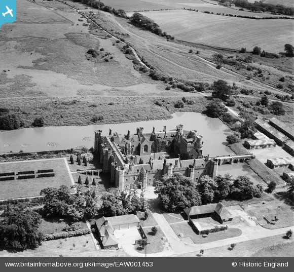
EAW001453 ENGLAND (1946). Herstmonceaux Castle, Herstmonceaux, 1946
© Copyright OpenStreetMap contributors and licensed by the OpenStreetMap Foundation. 2026. Cartography is licensed as CC BY-SA.
Nearby Images (7)
EAW001453

EAW014360

EAW014361

EAW001454

EAW014362

EAW014359

EAW001455

Details
| Title | [EAW001453] Herstmonceaux Castle, Herstmonceaux, 1946 |
| Reference | EAW001453 |
| Date | 3-July-1946 |
| Link | |
| Place name | HERSTMONCEAUX |
| Parish | HERSTMONCEUX |
| District | |
| Country | ENGLAND |
| Easting / Northing | 564708, 110380 |
| Longitude / Latitude | 0.34104910016016, 50.86886875362 |
| National Grid Reference | TQ647104 |
Pins

redmist |
Sunday 5th of November 2023 08:56:12 AM | |

Sparky |
Saturday 23rd of September 2017 07:40:29 AM | |
|
Sparky |
Saturday 23rd of September 2017 07:39:53 AM | |
|
Sparky |
Saturday 23rd of September 2017 07:39:22 AM |