
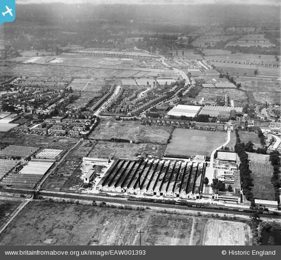
EAW001393 ENGLAND (1946). A factory and glasshouses around the Hertford Road, Holdbrook, 1946
© Copyright OpenStreetMap contributors and licensed by the OpenStreetMap Foundation. 2026. Cartography is licensed as CC BY-SA.
Nearby Images (7)
EAW001393

EAW001390

EAW001387

EAW001392

EAW001391

EAW001389

EAW001388

Details
| Title | [EAW001393] A factory and glasshouses around the Hertford Road, Holdbrook, 1946 |
| Reference | EAW001393 |
| Date | 2-July-1946 |
| Link | |
| Place name | HOLDBROOK |
| Parish | |
| District | |
| Country | ENGLAND |
| Easting / Northing | 536085, 199765 |
| Longitude / Latitude | -0.03145343154571, 51.679676956118 |
| National Grid Reference | TQ361998 |

