
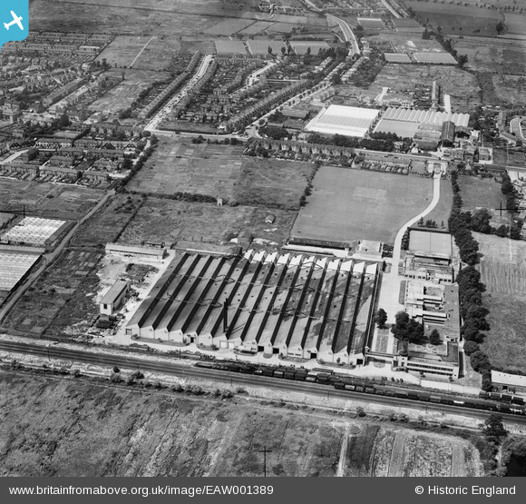
EAW001389 ENGLAND (1946). A factory and glasshouses around the Hertford Road, Holdbrook, 1946
© Copyright OpenStreetMap contributors and licensed by the OpenStreetMap Foundation. 2026. Cartography is licensed as CC BY-SA.
Nearby Images (7)
EAW001389

EAW001391

EAW001392

EAW001388

EAW001390

EAW001387

EAW001393

Details
| Title | [EAW001389] A factory and glasshouses around the Hertford Road, Holdbrook, 1946 |
| Reference | EAW001389 |
| Date | 2-July-1946 |
| Link | |
| Place name | HOLDBROOK |
| Parish | |
| District | |
| Country | ENGLAND |
| Easting / Northing | 536303, 199810 |
| Longitude / Latitude | -0.028284377943143, 51.680028493782 |
| National Grid Reference | TQ363998 |
Pins

Sparky |
Saturday 23rd of September 2017 11:00:13 PM | |
|
Sparky |
Sunday 6th of August 2017 09:17:54 AM | |

Ray Flack |
Sunday 17th of November 2013 12:35:30 PM | |
|
Ray Flack |
Sunday 17th of November 2013 12:35:06 PM | |
|
Ray Flack |
Sunday 17th of November 2013 12:34:35 PM |