
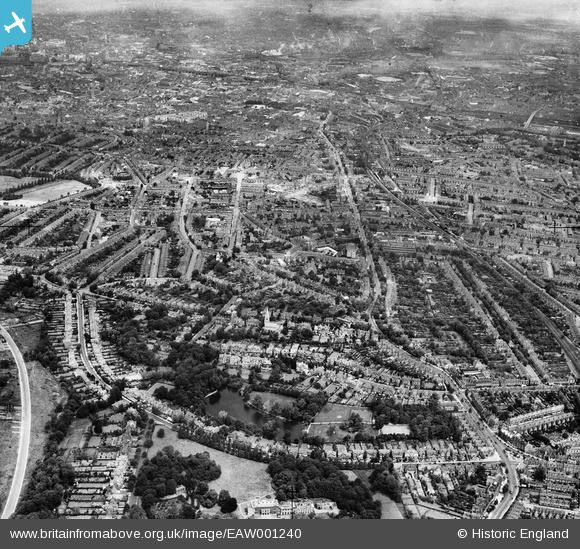
EAW001240 ENGLAND (1946). A cityscape from Moseley Park to Highgate, Moseley, from the south, 1946
© Copyright OpenStreetMap contributors and licensed by the OpenStreetMap Foundation. 2026. Cartography is licensed as CC BY-SA.
Nearby Images (2)
EAW001240

EPW018371

Details
| Title | [EAW001240] A cityscape from Moseley Park to Highgate, Moseley, from the south, 1946 |
| Reference | EAW001240 |
| Date | 24-June-1946 |
| Link | |
| Place name | MOSELEY |
| Parish | |
| District | |
| Country | ENGLAND |
| Easting / Northing | 407437, 283425 |
| Longitude / Latitude | -1.8905615829327, 52.448361790866 |
| National Grid Reference | SP074834 |
Pins

Warkshistorian |
Tuesday 24th of September 2024 06:14:37 PM | |
|
Warkshistorian |
Tuesday 24th of September 2024 06:13:42 PM | |
|
Graham |
Sunday 22nd of April 2018 09:07:16 PM | |
|
Paul |
Thursday 15th of February 2018 11:33:22 PM | |
|
Paul |
Thursday 15th of February 2018 11:29:59 PM | |
|
BhamChris |
Saturday 29th of July 2017 12:31:11 PM | |
|
Calpurnius |
Tuesday 21st of April 2015 05:09:40 AM | |
|
Calpurnius |
Tuesday 21st of April 2015 05:09:39 AM | |
|
Calpurnius |
Tuesday 21st of April 2015 05:04:47 AM | |
|
Calpurnius |
Tuesday 21st of April 2015 05:04:19 AM | |
|
Calpurnius |
Tuesday 21st of April 2015 05:03:34 AM | |
|
Calpurnius |
Tuesday 21st of April 2015 05:01:18 AM | |
|
Calpurnius |
Tuesday 21st of April 2015 04:59:41 AM | |
|
Steve |
Monday 6th of October 2014 02:04:34 PM | |
|
Steve |
Monday 6th of October 2014 02:02:03 PM | |
|
Steve |
Monday 6th of October 2014 01:58:40 PM | |
|
Steve |
Monday 6th of October 2014 01:56:54 PM |