
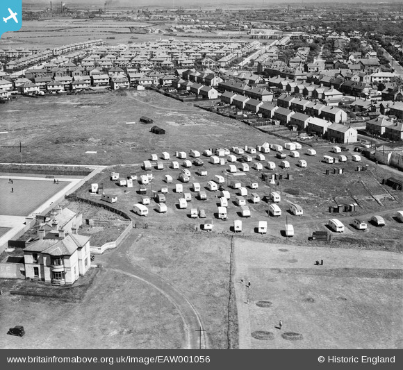
EAW001056 ENGLAND (1946). Rossall Mount and adjacent caravan park, Cleveleys, 1946
© Copyright OpenStreetMap contributors and licensed by the OpenStreetMap Foundation. 2026. Cartography is licensed as CC BY-SA.
Nearby Images (5)
EAW001056

EAW001059

EAW001058

EAW001057

EAW026240

Details
| Title | [EAW001056] Rossall Mount and adjacent caravan park, Cleveleys, 1946 |
| Reference | EAW001056 |
| Date | 3-June-1946 |
| Link | |
| Place name | CLEVELEYS |
| Parish | |
| District | |
| Country | ENGLAND |
| Easting / Northing | 331448, 443394 |
| Longitude / Latitude | -3.0429754434232, 53.881997368147 |
| National Grid Reference | SD314434 |
Pins
Be the first to add a comment to this image!