
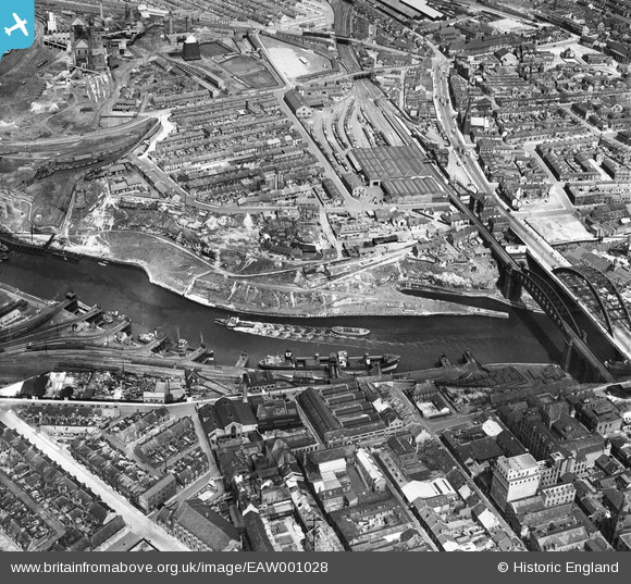
EAW001028 ENGLAND (1946). Monkwearmouth Goods Station, the River Wear and the surrounding industrial and residential area, Sunderland, 1946
© Copyright OpenStreetMap contributors and licensed by the OpenStreetMap Foundation. 2026. Cartography is licensed as CC BY-SA.
Nearby Images (14)
EAW001028

EPW051127

EPW020542

EAW001027

EPW020544

EAW022793

EAW022795

EAW022794

EAW022796

EAW022831

EPW020540

EAW022797

EAW022830

EPW020545

Details
| Title | [EAW001028] Monkwearmouth Goods Station, the River Wear and the surrounding industrial and residential area, Sunderland, 1946 |
| Reference | EAW001028 |
| Date | 6-June-1946 |
| Link | |
| Place name | SUNDERLAND |
| Parish | |
| District | |
| Country | ENGLAND |
| Easting / Northing | 439460, 557489 |
| Longitude / Latitude | -1.3844404543353, 54.910468099925 |
| National Grid Reference | NZ395575 |
Pins

redmist |
Friday 30th of September 2022 10:33:47 PM | |
|
redmist |
Friday 30th of September 2022 10:27:02 PM | |
|
redmist |
Friday 25th of October 2019 02:50:01 PM | |

Sparky |
Sunday 24th of September 2017 11:03:17 PM |