
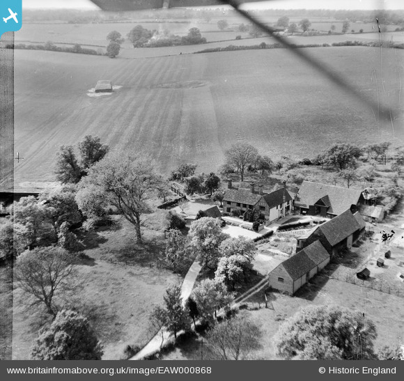
EAW000868 ENGLAND (1946). Tallents Farm, Kimpton, 1946
© Copyright OpenStreetMap contributors and licensed by the OpenStreetMap Foundation. 2026. Cartography is licensed as CC BY-SA.
Nearby Images (2)
EAW000868

EAW000867

Details
| Title | [EAW000868] Tallents Farm, Kimpton, 1946 |
| Reference | EAW000868 |
| Date | 15-May-1946 |
| Link | |
| Place name | KIMPTON |
| Parish | KIMPTON |
| District | |
| Country | ENGLAND |
| Easting / Northing | 515951, 217821 |
| Longitude / Latitude | -0.31652945200685, 51.84648724311 |
| National Grid Reference | TL160178 |
Pins

Sparky |
Friday 28th of July 2017 07:30:09 AM |