
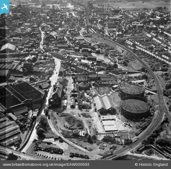
EAW000693 ENGLAND (1946). The Gaslight Co Gas Works, Worcester, 1946. This image has been produced from a damaged negative.
© Copyright OpenStreetMap contributors and licensed by the OpenStreetMap Foundation. 2026. Cartography is licensed as CC BY-SA.
Nearby Images (16)
EAW000693

EAW000695

EPW044985

EPW044990

EAW000697

EPW044987

EAW000694

EPW044991

EAW000691

EPW044989

EPW044988

EPW044986

EPW001299

EAW000692

EAW000696

EPW005415

Details
| Title | [EAW000693] The Gaslight Co Gas Works, Worcester, 1946. This image has been produced from a damaged negative. |
| Reference | EAW000693 |
| Date | 10-May-1946 |
| Link | |
| Place name | WORCESTER |
| Parish | |
| District | |
| Country | ENGLAND |
| Easting / Northing | 385473, 255366 |
| Longitude / Latitude | -2.2125576557893, 52.195935553939 |
| National Grid Reference | SO855554 |
Pins

peter stuart legat |
Monday 5th of April 2021 05:26:59 PM | |

Class31 |
Friday 20th of May 2016 08:14:40 PM | |
|
Class31 |
Friday 20th of May 2016 08:12:17 PM | |
|
gBr |
Thursday 3rd of September 2015 09:01:10 PM |

