
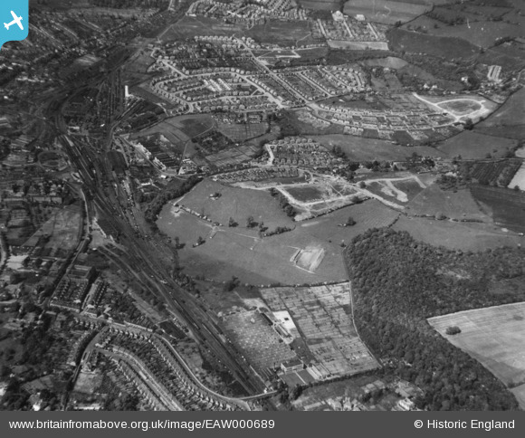
EAW000689 ENGLAND (1946). New residential area under construction between Perry Wood and Shrub Hill Railway Station, Worcester, 1946. This image has been produced from a print.
© Copyright OpenStreetMap contributors and licensed by the OpenStreetMap Foundation. 2026. Cartography is licensed as CC BY-SA.
Nearby Images (3)
EAW000689

EAW000690

EAW000687

Details
| Title | [EAW000689] New residential area under construction between Perry Wood and Shrub Hill Railway Station, Worcester, 1946. This image has been produced from a print. |
| Reference | EAW000689 |
| Date | 10-May-1946 |
| Link | |
| Place name | WORCESTER |
| Parish | |
| District | |
| Country | ENGLAND |
| Easting / Northing | 386204, 254962 |
| Longitude / Latitude | -2.201845355098, 52.192321814386 |
| National Grid Reference | SO862550 |
Pins

Matt Aldred edob.mattaldred.com |
Sunday 10th of March 2024 11:15:17 AM | |

Sparky |
Thursday 14th of September 2017 07:57:29 AM | |
|
Sparky |
Thursday 14th of September 2017 07:56:13 AM | |
|
Sparky |
Thursday 14th of September 2017 07:52:55 AM | |
|
Sparky |
Thursday 14th of September 2017 07:52:21 AM | |

Sonnyboythethird |
Saturday 6th of August 2016 08:11:26 PM | |

Daler |
Monday 6th of October 2014 10:28:40 PM |