
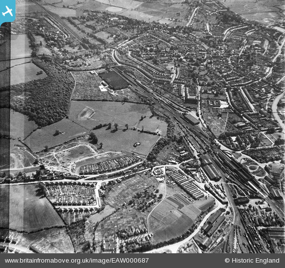
EAW000687 ENGLAND (1946). The residential area surrounding Shrub Hill Railway Station and the Perrywood Works, Worcester, 1946. This image has been produced from a damaged negative.
© Copyright OpenStreetMap contributors and licensed by the OpenStreetMap Foundation. 2026. Cartography is licensed as CC BY-SA.
Nearby Images (3)
EAW000687

EAW000690

EAW000689

Details
| Title | [EAW000687] The residential area surrounding Shrub Hill Railway Station and the Perrywood Works, Worcester, 1946. This image has been produced from a damaged negative. |
| Reference | EAW000687 |
| Date | 10-May-1946 |
| Link | |
| Place name | WORCESTER |
| Parish | |
| District | |
| Country | ENGLAND |
| Easting / Northing | 386080, 254870 |
| Longitude / Latitude | -2.2036557715012, 52.191491489311 |
| National Grid Reference | SO861549 |
Pins

Sonnyboythethird |
Saturday 6th of August 2016 08:05:31 PM | |

Class31 |
Friday 20th of May 2016 07:42:26 PM | |

Robin |
Wednesday 25th of December 2013 11:03:59 PM | |
|
Robin |
Wednesday 25th of December 2013 11:03:00 PM |
