
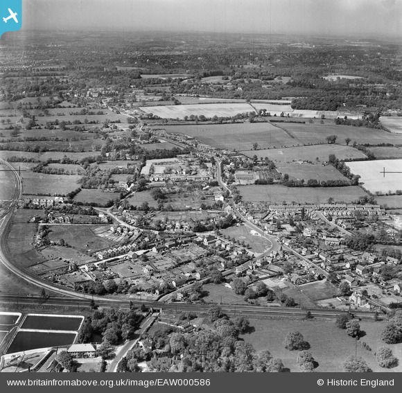
EAW000586 ENGLAND (1946). The village and surrounding countryside, Frimley Green, from the south, 1946
© Copyright OpenStreetMap contributors and licensed by the OpenStreetMap Foundation. 2026. Cartography is licensed as CC BY-SA.
Nearby Images (4)
EAW000586

EAW000588

EAW000590

EPW044881

Details
| Title | [EAW000586] The village and surrounding countryside, Frimley Green, from the south, 1946 |
| Reference | EAW000586 |
| Date | 10-May-1946 |
| Link | |
| Place name | FRIMLEY GREEN |
| Parish | |
| District | |
| Country | ENGLAND |
| Easting / Northing | 488747, 156511 |
| Longitude / Latitude | -0.72687044153749, 51.300290355067 |
| National Grid Reference | SU887565 |
Pins

Sparky |
Tuesday 26th of September 2017 01:47:32 PM | |

markhortonphotography |
Monday 3rd of March 2014 07:06:23 PM | |
|
markhortonphotography |
Monday 3rd of March 2014 07:05:10 PM | |
|
markhortonphotography |
Monday 3rd of March 2014 07:04:00 PM | |
|
markhortonphotography |
Monday 3rd of March 2014 06:50:43 PM |