
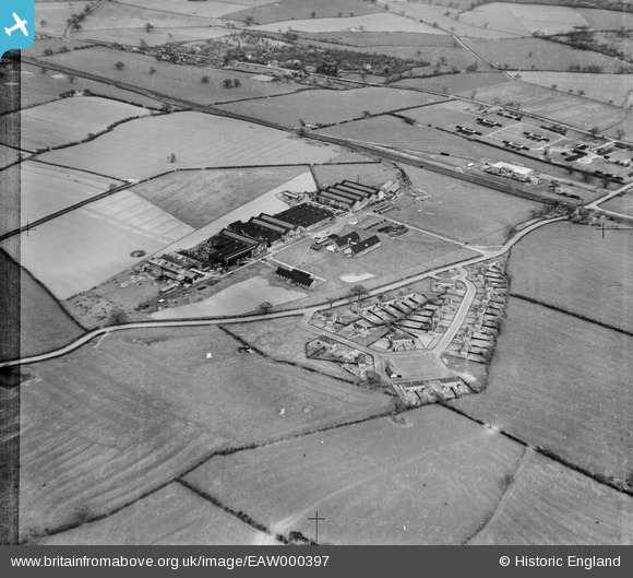
EAW000397 ENGLAND (1946). The Chatwood Safe Company Works and housing at Harlescott Crescent, Harlescott, 1946. This image has been produced from a damaged negative.
© Copyright OpenStreetMap contributors and licensed by the OpenStreetMap Foundation. 2026. Cartography is licensed as CC BY-SA.
Nearby Images (43)
EAW000397

EAW000396

EAW001110

EAW001621

EAW001106

EAW001624

EAW001107

EAW000398

EPW023300

EAW001623

EAW001625

EAW000394

EAW001626

EAW001622

EPW023301

EAW000395

EPW028835

EPW028833

EPW023303

EAW000399

EPW028839

EPW028832

EPW028836

EPW023336

EAW001620

EPW028838

EPW028831

EPW028834

EPW028841

EAW001111

EAW001109

EAW001619

EAW001627

EPW028837

EPW028840

EPW023304

EPW023339

EAW000393

EPW023334

EPW023337

EPW023335

EPW023338

EPW023305

Details
| Title | [EAW000397] The Chatwood Safe Company Works and housing at Harlescott Crescent, Harlescott, 1946. This image has been produced from a damaged negative. |
| Reference | EAW000397 |
| Date | 17-April-1946 |
| Link | |
| Place name | HARLESCOTT |
| Parish | SHREWSBURY |
| District | |
| Country | ENGLAND |
| Easting / Northing | 350613, 316121 |
| Longitude / Latitude | -2.7315980117131, 52.740120402203 |
| National Grid Reference | SJ506161 |
