
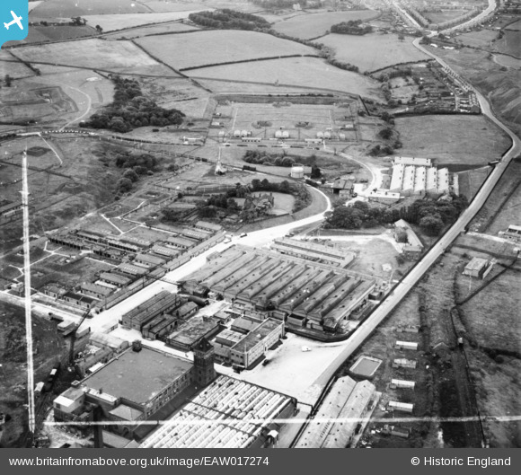
eaw017274 ENGLAND (1948). H. J. Heinz Co Ltd Factory, Standish, 1948. This image has been produced from a print marked by Aerofilms Ltd for photo editing.
© Copyright OpenStreetMap contributors and licensed by the OpenStreetMap Foundation. 2024. Cartography is licensed as CC BY-SA.
Nearby Images (21)
EAW017274

EAW017273

EAW017266

EAW017272

EAW017270

EAW017267

EAW017271

EAW017269

EAW017268

EAW032683

EAW032679

EAW032677

EAW032675

EAW032682

EAW032680

EAW032681

EAW032672

EAW032678

EAW032676

EAW032674

EAW032673

Details
| Title | [EAW017274] H. J. Heinz Co Ltd Factory, Standish, 1948. This image has been produced from a print marked by Aerofilms Ltd for photo editing. |
| Reference | EAW017274 |
| Date | 19-July-1948 |
| Link | |
| Place name | STANDISH |
| Parish | |
| District | |
| Country | ENGLAND |
| Easting / Northing | 357060, 411036 |
| Longitude / Latitude | -2.6488457352311, 53.593899807912 |
| National Grid Reference | SD571110 |
Pins
 Matt Aldred edob.mattaldred.com |
Wednesday 6th of October 2021 02:58:50 PM | |
Matt Aldred edob.mattaldred.com |
Wednesday 6th of October 2021 02:58:35 PM |


