
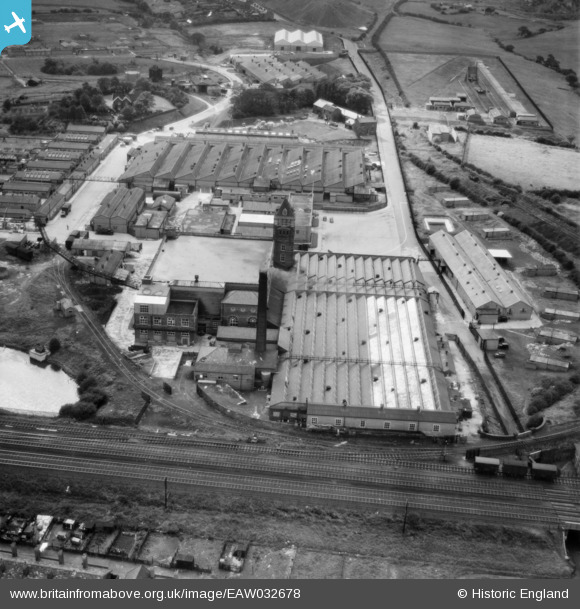
EAW032678 ENGLAND (1950). The Carrington and Dewhurst Ltd Douglas Mill, Standish, 1950
© Copyright OpenStreetMap contributors and licensed by the OpenStreetMap Foundation. 2024. Cartography is licensed as CC BY-SA.
Nearby Images (18)
EAW032678

EAW032672

EAW032675

EAW032676

EAW032681

EAW032680

EAW032677

EAW032682

EAW032674

EAW032679

EAW032683

EAW032673

EAW017269

EAW017268

EAW017271

EAW017266

EAW017274

EAW017273

Details
| Title | [EAW032678] The Carrington and Dewhurst Ltd Douglas Mill, Standish, 1950 |
| Reference | EAW032678 |
| Date | 24-September-1950 |
| Link | |
| Place name | STANDISH |
| Parish | |
| District | |
| Country | ENGLAND |
| Easting / Northing | 357254, 411209 |
| Longitude / Latitude | -2.6459382182207, 53.595470719626 |
| National Grid Reference | SD573112 |
Pins
Be the first to add a comment to this image!


