
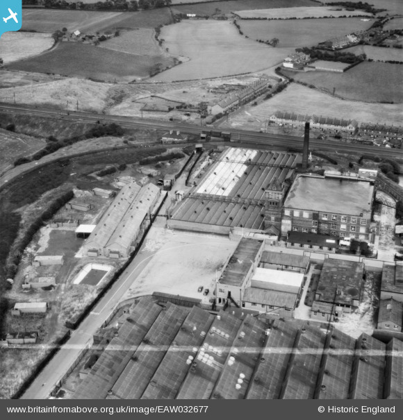
EAW032677 ENGLAND (1950). The Carrington and Dewhurst Ltd Douglas Mill, Standish, 1950. This image was marked by Aerofilms Ltd for photo editing.
© Copyright OpenStreetMap contributors and licensed by the OpenStreetMap Foundation. 2024. Cartography is licensed as CC BY-SA.
Nearby Images (21)
EAW032677

EAW032679

EAW032682

EAW032680

EAW032681

EAW032683

EAW032675

EAW032678

EAW032672

EAW017269

EAW032676

EAW032673

EAW017268

EAW032674

EAW017271

EAW017274

EAW017273

EAW017266

EAW017270

EAW017267

EAW017272

Details
| Title | [EAW032677] The Carrington and Dewhurst Ltd Douglas Mill, Standish, 1950. This image was marked by Aerofilms Ltd for photo editing. |
| Reference | EAW032677 |
| Date | 24-September-1950 |
| Link | |
| Place name | STANDISH |
| Parish | |
| District | |
| Country | ENGLAND |
| Easting / Northing | 357213, 411221 |
| Longitude / Latitude | -2.6465593760474, 53.595575238832 |
| National Grid Reference | SD572112 |


