
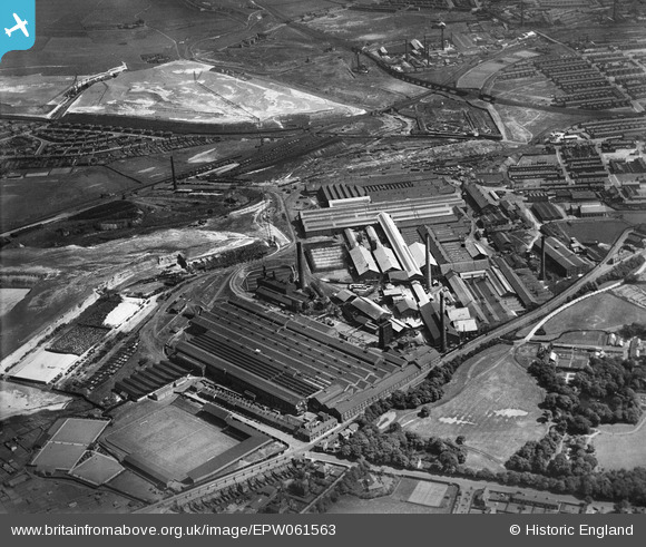
EPW061563 ENGLAND (1939). The Gerard's Bridge Plate Glass Works and Sand Lodge, St Helens, 1939
© Copyright OpenStreetMap contributors and licensed by the OpenStreetMap Foundation. 2024. Cartography is licensed as CC BY-SA.
Nearby Images (28)
EPW061563

EPW009318

EAW012390

EAW013757

EPW061567

EPW061568

EPW061564

EPW009312

EAW012393

EPW061565

EAW012387

EPW061570

EAW013763

EPW009316

EPW009317

EPW061571

EPW061562

EPW061569

EPW009311

EAW012389

EPW061566

EAW013754

EAW013758

EAW013770

EAW013766

EAW012388

EPW009319

EPW009310

Details
| Title | [EPW061563] The Gerard's Bridge Plate Glass Works and Sand Lodge, St Helens, 1939 |
| Reference | EPW061563 |
| Date | 4-June-1939 |
| Link | |
| Place name | ST HELENS |
| Parish | |
| District | |
| Country | ENGLAND |
| Easting / Northing | 351119, 396622 |
| Longitude / Latitude | -2.736358769212, 53.463816662039 |
| National Grid Reference | SJ511966 |
Pins
 Matt Aldred edob.mattaldred.com |
Saturday 22nd of April 2023 06:47:27 PM | |
 pauloyick |
Saturday 21st of December 2013 04:42:08 PM | |
pauloyick |
Saturday 21st of December 2013 04:39:24 PM | |
True, but check out those pitch markings ! Interesting too compared with 1923 views. |
gBr |
Saturday 18th of March 2017 10:58:41 AM |


