
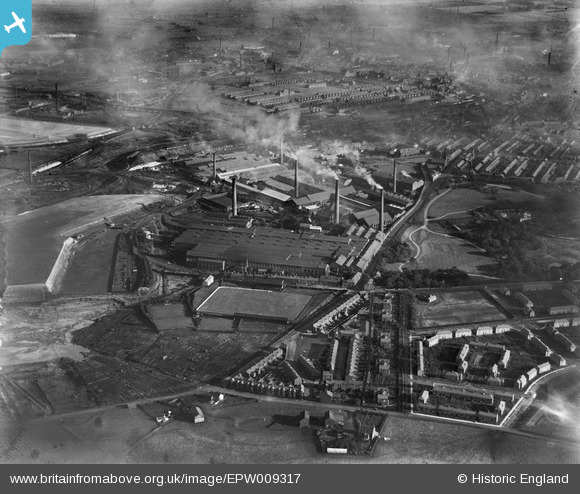
EPW009317 ENGLAND (1923). The Gerard's Bridge Works, St Helens, 1923
© Copyright OpenStreetMap contributors and licensed by the OpenStreetMap Foundation. 2024. Cartography is licensed as CC BY-SA.
Nearby Images (28)
EPW009317

EPW061571

EAW013763

EPW009311

EPW009316

EPW061567

EAW013758

EAW013757

EPW009310

EPW061570

EPW009319

EPW061563

EPW009314

EAW013767

EAW012389

EAW013759

EAW013755

EPW061562

EAW013756

EPW009318

EAW012390

EAW012388

EPW061566

EPW061568

EPW061569

EPW009312

EAW013760

EPW061564

Details
| Title | [EPW009317] The Gerard's Bridge Works, St Helens, 1923 |
| Reference | EPW009317 |
| Date | 1923 |
| Link | |
| Place name | ST HELENS |
| Parish | |
| District | |
| Country | ENGLAND |
| Easting / Northing | 350968, 396700 |
| Longitude / Latitude | -2.7386454443936, 53.464503747666 |
| National Grid Reference | SJ510967 |
Pins
 pauloyick |
Tuesday 7th of January 2014 07:12:12 PM |


