
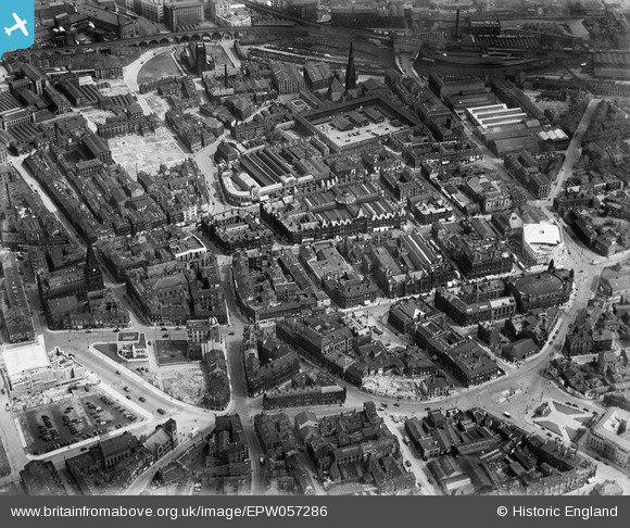
EPW057286 ENGLAND (1938). The town centre, Halifax, 1938
© Copyright OpenStreetMap contributors and licensed by the OpenStreetMap Foundation. 2024. Cartography is licensed as CC BY-SA.
Nearby Images (13)
EPW057286

EPW024490

EPW036890

EPW036889

EPW057283

EPW036891

EPW024491

EPW013883

EPW013881

EAW028059

EPW057287

EAW028058

EPW057285

Details
| Title | [EPW057286] The town centre, Halifax, 1938 |
| Reference | EPW057286 |
| Date | 25-May-1938 |
| Link | |
| Place name | HALIFAX |
| Parish | |
| District | |
| Country | ENGLAND |
| Easting / Northing | 409316, 425153 |
| Longitude / Latitude | -1.8588022104216, 53.722476567427 |
| National Grid Reference | SE093252 |
Pins
Be the first to add a comment to this image!


