
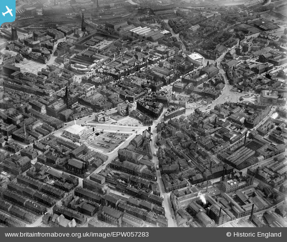
EPW057283 ENGLAND (1938). The town centre, Halifax, 1938
© Copyright OpenStreetMap contributors and licensed by the OpenStreetMap Foundation. 2024. Cartography is licensed as CC BY-SA.
Nearby Images (11)
EPW057283

EAW028059

EPW024491

EPW036890

EPW036889

EPW036891

EPW057286

EAW028058

EPW057284

EPW024490

EAW028053

Details
| Title | [EPW057283] The town centre, Halifax, 1938 |
| Reference | EPW057283 |
| Date | 25-May-1938 |
| Link | |
| Place name | HALIFAX |
| Parish | |
| District | |
| Country | ENGLAND |
| Easting / Northing | 409167, 425237 |
| Longitude / Latitude | -1.8610580300015, 53.72323429142 |
| National Grid Reference | SE092252 |
Pins
Be the first to add a comment to this image!


