
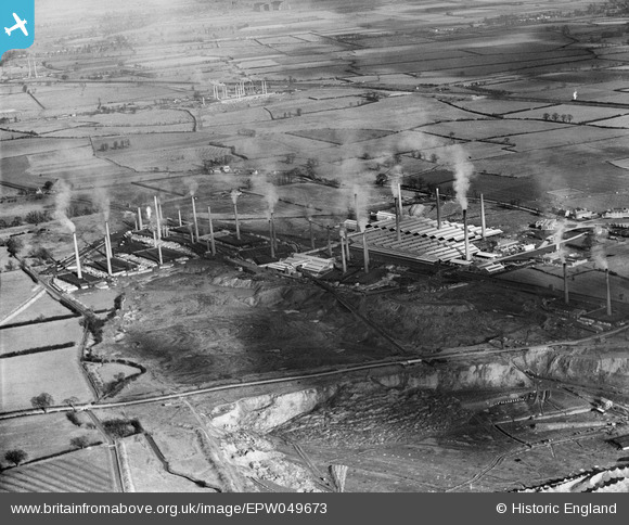
EPW049673 ENGLAND (1936). The Pillinge Brick Works and environs, Stewartby, 1936
© Copyright OpenStreetMap contributors and licensed by the OpenStreetMap Foundation. 2024. Cartography is licensed as CC BY-SA.
Nearby Images (28)
EPW049673

EPW054971

EAW045814

EPW033898

EPW054969A

EPW049676

EAW045596

EAW011278

EAW045816

EAW045819

EPW026700

EAW045817

EPW049681

EAW045815

EAW045818

EPW033894

EPW054973

EAW045599

EPW026693

EAW045600

EPW026696

EPW026695

EPW054974

EAW011280

EPW033895

EAW045820

EPW033903

EAW011279

Details
| Title | [EPW049673] The Pillinge Brick Works and environs, Stewartby, 1936 |
| Reference | EPW049673 |
| Date | February-1936 |
| Link | |
| Place name | STEWARTBY |
| Parish | STEWARTBY |
| District | |
| Country | ENGLAND |
| Easting / Northing | 501718, 242833 |
| Longitude / Latitude | -0.51568753735322, 52.074090273316 |
| National Grid Reference | TL017428 |
Pins
Be the first to add a comment to this image!
User Comment Contributions
At the height of the brick production in the Marston Vale there were 167 brickyard chimneys. Now there is no brick production and only four chimneys remain. |
 melgibbs |
Tuesday 16th of July 2013 09:23:22 PM |


