
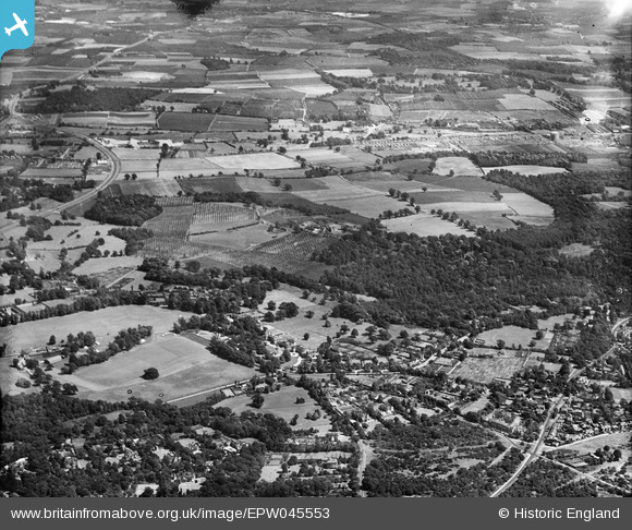
EPW045553 ENGLAND (1934). Holbrook Lane, Park Wood and environs, Chislehurst, from the north-west, 1934
© Copyright OpenStreetMap contributors and licensed by the OpenStreetMap Foundation. 2024. Cartography is licensed as CC BY-SA.
Nearby Images (11)
EPW045553

EPW026046

EPW026613

EPW026605

EPW026611

EPW026607

EPW026612

EPW026610

EPW026609

EPW026614

EPW026606

Details
| Title | [EPW045553] Holbrook Lane, Park Wood and environs, Chislehurst, from the north-west, 1934 |
| Reference | EPW045553 |
| Date | July-1934 |
| Link | |
| Place name | CHISLEHURST |
| Parish | |
| District | |
| Country | ENGLAND |
| Easting / Northing | 544778, 170396 |
| Longitude / Latitude | 0.082121710995207, 51.41357975684 |
| National Grid Reference | TQ448704 |
Pins
 Gone2Kent |
Tuesday 31st of December 2013 03:31:43 PM | |
Mike Floate |
Tuesday 24th of December 2013 09:24:53 PM |


