
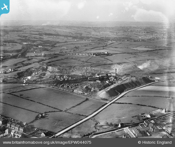
EPW044075 ENGLAND (1934). The Pye Hill Colliery and surrounding countryside, Jacksdale, from the south, 1934
© Copyright OpenStreetMap contributors and licensed by the OpenStreetMap Foundation. 2024. Cartography is licensed as CC BY-SA.
Nearby Images (7)
EPW044075

EPW044070

EAW002806

EPW044069

EPW044072

EAW002803

EAW002804

Details
| Title | [EPW044075] The Pye Hill Colliery and surrounding countryside, Jacksdale, from the south, 1934 |
| Reference | EPW044075 |
| Date | April-1934 |
| Link | |
| Place name | JACKSDALE |
| Parish | SELSTON |
| District | |
| Country | ENGLAND |
| Easting / Northing | 444666, 352055 |
| Longitude / Latitude | -1.3333919208141, 53.063569221741 |
| National Grid Reference | SK447521 |


