
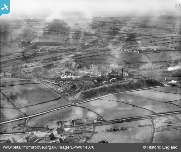
EPW044070 ENGLAND (1934). The Pye Hill Colliery and surrounding countryside, Jacksdale, from the south-east, 1934
© Copyright OpenStreetMap contributors and licensed by the OpenStreetMap Foundation. 2024. Cartography is licensed as CC BY-SA.
Nearby Images (4)
EPW044070

EPW044075

EAW002803

EAW002806

Details
| Title | [EPW044070] The Pye Hill Colliery and surrounding countryside, Jacksdale, from the south-east, 1934 |
| Reference | EPW044070 |
| Date | April-1934 |
| Link | |
| Place name | JACKSDALE |
| Parish | SELSTON |
| District | |
| Country | ENGLAND |
| Easting / Northing | 444759, 352019 |
| Longitude / Latitude | -1.3320090719777, 53.063237816335 |
| National Grid Reference | SK448520 |
Pins
Be the first to add a comment to this image!


