
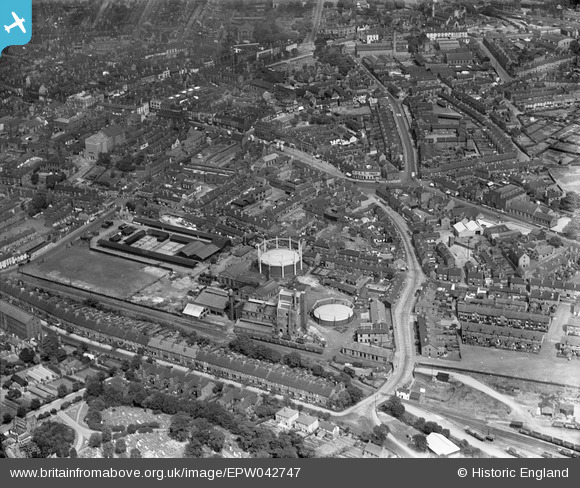
EPW042747 ENGLAND (1933). The Cattle Market and town centre, Newcastle-under-Lyme, 1933
© Copyright OpenStreetMap contributors and licensed by the OpenStreetMap Foundation. 2024. Cartography is licensed as CC BY-SA.
Nearby Images (5)
EPW042747

EPW042745

EPW020010

EPW028090

EPW042746

Details
| Title | [EPW042747] The Cattle Market and town centre, Newcastle-under-Lyme, 1933 |
| Reference | EPW042747 |
| Date | August-1933 |
| Link | |
| Place name | NEWCASTLE-UNDER-LYME |
| Parish | |
| District | |
| Country | ENGLAND |
| Easting / Northing | 384927, 345715 |
| Longitude / Latitude | -2.2246646507623, 53.008226550859 |
| National Grid Reference | SJ849457 |
Pins
 johnxyz |
Wednesday 4th of December 2019 07:36:15 PM | |
johnxyz |
Wednesday 4th of December 2019 07:33:38 PM | |
ullymike |
Friday 4th of April 2014 11:14:06 AM | |
ullymike |
Friday 4th of April 2014 11:12:50 AM | |
ullymike |
Friday 4th of April 2014 11:12:07 AM | |
ullymike |
Friday 4th of April 2014 11:11:28 AM | |
ullymike |
Friday 4th of April 2014 11:10:40 AM | |
ullymike |
Friday 4th of April 2014 11:09:51 AM | |
 bescotbeast |
Friday 28th of February 2014 07:39:24 PM | |
bescotbeast |
Friday 28th of February 2014 07:36:30 PM | |
bescotbeast |
Friday 28th of February 2014 07:35:49 PM |


