
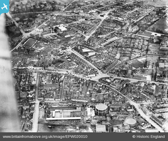
EPW020010 ENGLAND (1927). Penkhull Street and environs, Newcastle-under-Lyme, 1927
© Copyright OpenStreetMap contributors and licensed by the OpenStreetMap Foundation. 2024. Cartography is licensed as CC BY-SA.
Nearby Images (6)
EPW020010

EPW042745

EPW042746

EPW028090

EPW042747

EPW020016

Details
| Title | [EPW020010] Penkhull Street and environs, Newcastle-under-Lyme, 1927 |
| Reference | EPW020010 |
| Date | October-1927 |
| Link | |
| Place name | NEWCASTLE-UNDER-LYME |
| Parish | |
| District | |
| Country | ENGLAND |
| Easting / Northing | 385032, 345852 |
| Longitude / Latitude | -2.2231059787214, 53.009461145593 |
| National Grid Reference | SJ850459 |
Pins
 BRE |
Sunday 6th of September 2015 07:51:33 PM | |
BRE |
Sunday 6th of September 2015 07:50:54 PM | |
Barny |
Thursday 1st of January 2015 07:00:01 PM | |
BerksB |
Tuesday 12th of August 2014 05:31:49 PM | |
BerksB |
Tuesday 12th of August 2014 05:29:38 PM | |
staffsmod |
Friday 4th of October 2013 10:55:56 AM | |
staffsmod |
Friday 4th of October 2013 10:48:48 AM | |
staffsmod |
Friday 4th of October 2013 10:47:35 AM | |
staffsmod |
Friday 4th of October 2013 10:42:24 AM | |
staffsmod |
Friday 4th of October 2013 10:41:52 AM | |
staffsmod |
Friday 4th of October 2013 10:41:13 AM |


