
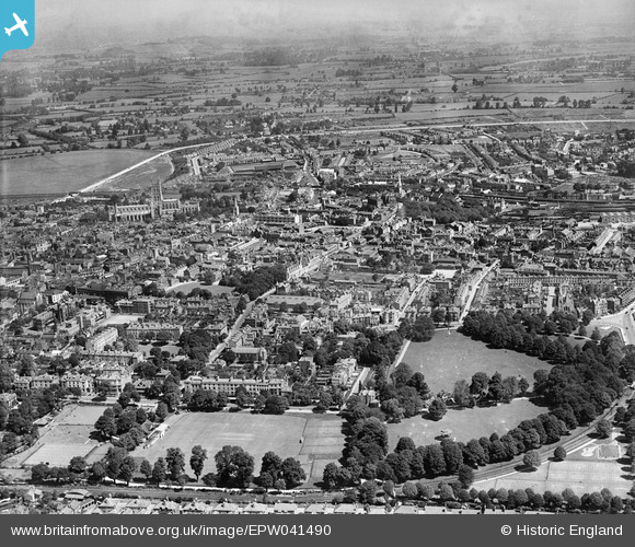
EPW041490 ENGLAND (1933). The Park and the city centre, Gloucester, from the south, 1933
© Copyright OpenStreetMap contributors and licensed by the OpenStreetMap Foundation. 2024. Cartography is licensed as CC BY-SA.
Nearby Images (7)
EPW041490

EPW024171

EPW050781

EPW050779

EPW050780

EPW050782

EAW018731

Details
| Title | [EPW041490] The Park and the city centre, Gloucester, from the south, 1933 |
| Reference | EPW041490 |
| Date | July-1933 |
| Link | |
| Place name | GLOUCESTER |
| Parish | |
| District | |
| Country | ENGLAND |
| Easting / Northing | 383186, 218128 |
| Longitude / Latitude | -2.2441899209993, 51.861040789134 |
| National Grid Reference | SO832181 |
Pins
Be the first to add a comment to this image!


