
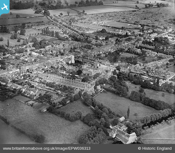
EPW036313 ENGLAND (1931). The town centre, Stony Stratford, 1931
© Copyright OpenStreetMap contributors and licensed by the OpenStreetMap Foundation. 2024. Cartography is licensed as CC BY-SA.
Nearby Images (7)
EPW036313

EPW022449

EPW022447

EPW022450

EPW036316

EPW022485

EPW036315

Details
| Title | [EPW036313] The town centre, Stony Stratford, 1931 |
| Reference | EPW036313 |
| Date | August-1931 |
| Link | |
| Place name | STONY STRATFORD |
| Parish | STONY STRATFORD |
| District | |
| Country | ENGLAND |
| Easting / Northing | 478620, 240417 |
| Longitude / Latitude | -0.85321609830749, 52.056132959006 |
| National Grid Reference | SP786404 |


