
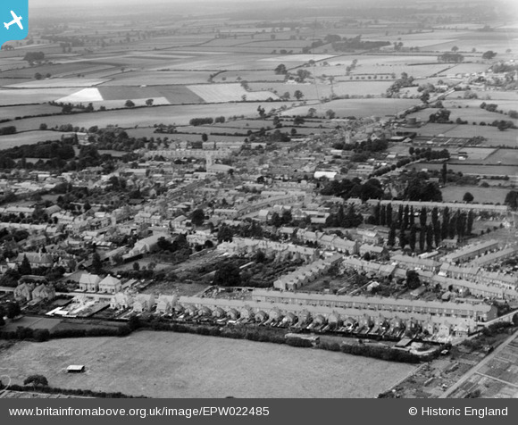
EPW022485 ENGLAND (1928). The town, Stony Stratford, 1928
© Copyright OpenStreetMap contributors and licensed by the OpenStreetMap Foundation. 2024. Cartography is licensed as CC BY-SA.
Nearby Images (8)
EPW022485

EPW022450

EPW022449

EPW022447

EPW022452

EPW036314

EPW036313

EAW009509

Details
| Title | [EPW022485] The town, Stony Stratford, 1928 |
| Reference | EPW022485 |
| Date | 9-August-1928 |
| Link | |
| Place name | STONY STRATFORD |
| Parish | STONY STRATFORD |
| District | |
| Country | ENGLAND |
| Easting / Northing | 478862, 240458 |
| Longitude / Latitude | -0.84967748650727, 52.056467145764 |
| National Grid Reference | SP789405 |
Pins
 Class31 |
Monday 29th of October 2012 12:34:41 PM | |
Class31 |
Monday 29th of October 2012 12:33:21 PM | |
Class31 |
Monday 29th of October 2012 12:32:36 PM | |
Class31 |
Monday 29th of October 2012 12:32:21 PM | |
Class31 |
Monday 29th of October 2012 12:31:49 PM |


