
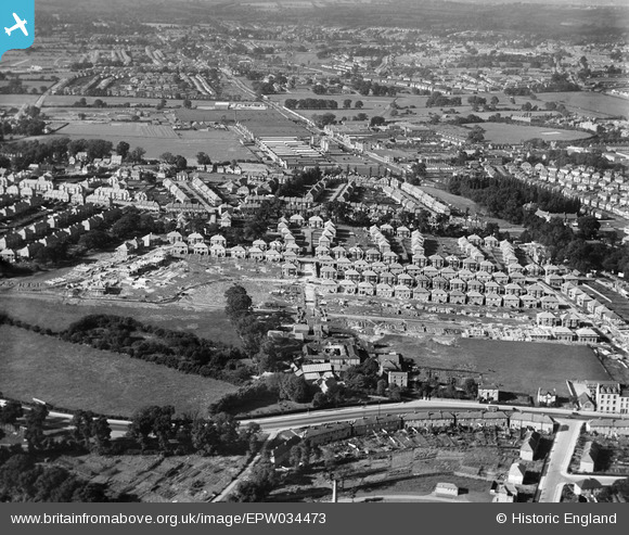
EPW034473 ENGLAND (1930). Housing under construction at Derwent Avenue and environs, Kingsbury, 1930
© Copyright OpenStreetMap contributors and licensed by the OpenStreetMap Foundation. 2024. Cartography is licensed as CC BY-SA.
Nearby Images (8)
EPW034473

EPW034476

EPW034483

EPW034482

EPW034479

EPW034481

EPW034480

EPW034477

Details
| Title | [EPW034473] Housing under construction at Derwent Avenue and environs, Kingsbury, 1930 |
| Reference | EPW034473 |
| Date | August-1930 |
| Link | |
| Place name | KINGSBURY |
| Parish | |
| District | |
| Country | ENGLAND |
| Easting / Northing | 521059, 188875 |
| Longitude / Latitude | -0.2524635513091, 51.585237152942 |
| National Grid Reference | TQ211889 |
Pins
 Dank |
Thursday 24th of December 2015 11:44:04 AM |


