
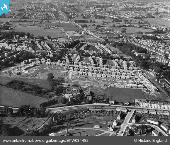
EPW034482 ENGLAND (1930). Housing under construction at Springfield Mount and environs, Kingsbury, 1930
© Copyright OpenStreetMap contributors and licensed by the OpenStreetMap Foundation. 2024. Cartography is licensed as CC BY-SA.
Nearby Images (8)
EPW034482

EPW034483

EPW034476

EPW034473

EPW034479

EPW034481

EPW034480

EPW034477

Details
| Title | [EPW034482] Housing under construction at Springfield Mount and environs, Kingsbury, 1930 |
| Reference | EPW034482 |
| Date | August-1930 |
| Link | |
| Place name | KINGSBURY |
| Parish | |
| District | |
| Country | ENGLAND |
| Easting / Northing | 521108, 188860 |
| Longitude / Latitude | -0.25176174630998, 51.585091799566 |
| National Grid Reference | TQ211889 |
Pins
 The Laird |
Sunday 18th of November 2018 05:51:42 PM | |
The Laird |
Sunday 18th of November 2018 05:39:21 PM |


