
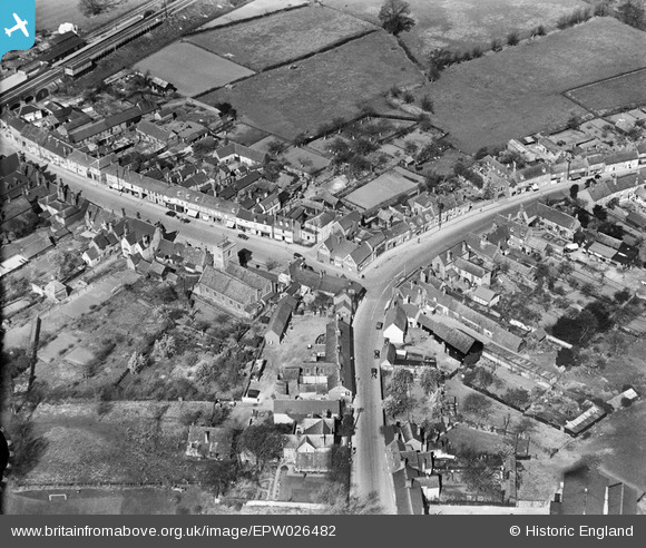
EPW026482 ENGLAND (1929). St Michael's Church and the village centre, Shefford, 1929
© Copyright OpenStreetMap contributors and licensed by the OpenStreetMap Foundation. 2024. Cartography is licensed as CC BY-SA.
Nearby Images (5)
EPW026482

EPW026483

EPW026479

EPW026480

EPW026477

Details
| Title | [EPW026482] St Michael's Church and the village centre, Shefford, 1929 |
| Reference | EPW026482 |
| Date | May-1929 |
| Link | |
| Place name | SHEFFORD |
| Parish | SHEFFORD |
| District | |
| Country | ENGLAND |
| Easting / Northing | 514348, 239108 |
| Longitude / Latitude | -0.33271218240884, 52.038146215811 |
| National Grid Reference | TL143391 |
Pins
 Deleted User |
Monday 8th of December 2014 03:27:57 PM | |
Deleted User |
Monday 8th of December 2014 03:25:50 PM | |
Deleted User |
Monday 8th of December 2014 03:24:32 PM | |
 melgibbs |
Thursday 26th of December 2013 08:56:02 PM | |
melgibbs |
Thursday 26th of December 2013 08:51:39 PM | |
melgibbs |
Thursday 26th of December 2013 08:51:02 PM | |
melgibbs |
Thursday 26th of December 2013 08:50:41 PM |


