
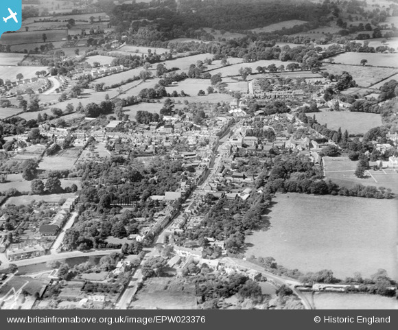
EPW023376 ENGLAND (1928). London Street and the town centre, Chertsey, 1928
© Copyright OpenStreetMap contributors and licensed by the OpenStreetMap Foundation. 2024. Cartography is licensed as CC BY-SA.
Nearby Images (7)
EPW023376

EPW026282

EPW023378

EPW023379

EPW026275

EAW003683

EPW026272

Details
| Title | [EPW023376] London Street and the town centre, Chertsey, 1928 |
| Reference | EPW023376 |
| Date | September-1928 |
| Link | |
| Place name | CHERTSEY |
| Parish | |
| District | |
| Country | ENGLAND |
| Easting / Northing | 504270, 166905 |
| Longitude / Latitude | -0.50121360370206, 51.391096881439 |
| National Grid Reference | TQ043669 |
Pins
 bumblee |
Wednesday 13th of May 2015 10:46:45 AM | |
bumblee |
Sunday 4th of January 2015 01:48:00 PM | |
bumblee |
Sunday 4th of January 2015 01:46:20 PM | |
bumblee |
Sunday 4th of January 2015 01:45:43 PM | |
bumblee |
Wednesday 1st of October 2014 02:36:26 PM |


